Key takeaways
- A digital twin is a 3D model of a real asset kept up to date with data from that asset.
- The live data connection is what separates a twin from a 3D model, a BIM file or a virtual tour.
- The most useful twins start small: one asset, a few sensors and one question to answer.
- Typical returns are fewer site visits, earlier fault detection, better-planned work and training on the same model.
What is a digital twin?
A digital twin is a virtual model of a real thing that is kept up to date with data from that thing. The "thing" can be a single pump, a whole machine, a building, a mine or a city block. The model is usually 3D, and the data comes from cameras, sensors, machine controllers and business systems.
Every digital twin has three parts:
- The physical asset: the site, building or machine in the real world.
- The virtual model: a 3D copy built from laser scans, drone surveys, CAD drawings or BIM.
- The connection: a steady flow of data from the asset to the model, and sometimes back again.
Take away the connection and you're left with a 3D model: useful, but frozen on the day it was made. The connection is what makes it a twin. When the pump stops, the twin shows it stopped. When the ground moves, the twin shows how far.
Digital twin vs 3D model vs BIM vs virtual tour
These terms get used interchangeably, and that causes expensive misunderstandings. The difference is mostly about whether the model is connected to live data, and what it is used for.
| What it is | Live data? | Typical use | |
|---|---|---|---|
| 3D model | Geometry of an object or place | No | Design, visualisation, marketing |
| BIM | 3D model plus information about each building element | Usually not | Design, construction coordination, handover |
| Virtual tour | Linked 360-degree photos | No | Real estate listings, remote walkthroughs |
| Digital twin | 3D model connected to data from the real asset | Yes | Monitoring, inspection, maintenance, planning, training |
A good BIM model or survey is often the starting point for a twin. It becomes a twin when you connect it to what is happening now.
How a digital twin works
Most twins follow the same four steps, whatever the industry.
- Capture. The asset is measured and modelled: laser scanning for precise geometry, drone photogrammetry for large outdoor sites, CAD or BIM for buildings and machines that already have drawings.
- Connect. Cameras, sensors and machine telemetry are linked to the model through a gateway. On remote sites that link might be 4G or 5G, satellite or a low-power radio network such as LoRaWAN.
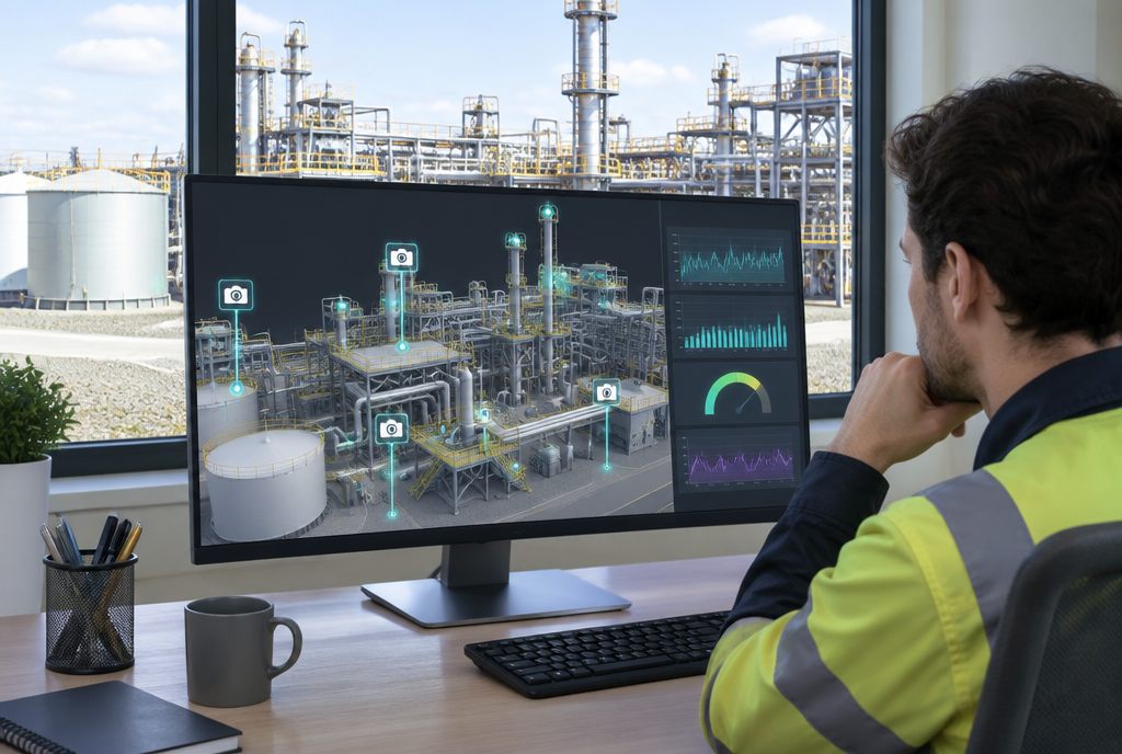
- Contextualise. Each data stream is pinned to its real location. A vibration reading appears on the bearing it measures; a camera feed appears where the camera is mounted.
- Act. Thresholds raise alerts, dashboards summarise the day, and people use the twin to decide what to do and where to send crews.
Types of digital twin
Twins are usually described by scale. Start with the smallest one that answers your question.
- Component twin: one critical part, such as a gearbox or a pump, with a handful of sensors.
- Asset or machine twin: a whole machine, such as an excavator, crane or conveyor, linked to its telemetry and service history.
- Building or property twin: a building with its spaces, services and sensors, used for sales, leasing and facility management.
- Site twin: a mine, quarry, construction site, farm or treatment plant, with cameras and environmental sensors across it.
- Process twin: a model of how material, people or vehicles flow, used to test changes before making them.
What digital twins are used for
Mining and quarrying
Monitoring pit walls, tailings, pumps and conveyors from a central office; planning shutdowns; and giving new workers a walk through the site before they set foot on it.
Construction
Comparing progress against the plan with regular drone captures, checking that what was built matches the design, and handing the owner a model that's actually useful after practical completion.
Real estate and property
Letting buyers walk an apartment before it's built, giving facility managers a 3D view of building services, and checking on vacant or remote properties without a drive. We cover this in detail in digital twins in real estate.
Utilities and infrastructure
Pump stations, substations, bridges and pipelines spread across large distances are natural candidates. A twin tells you which ones need a visit today.
Training
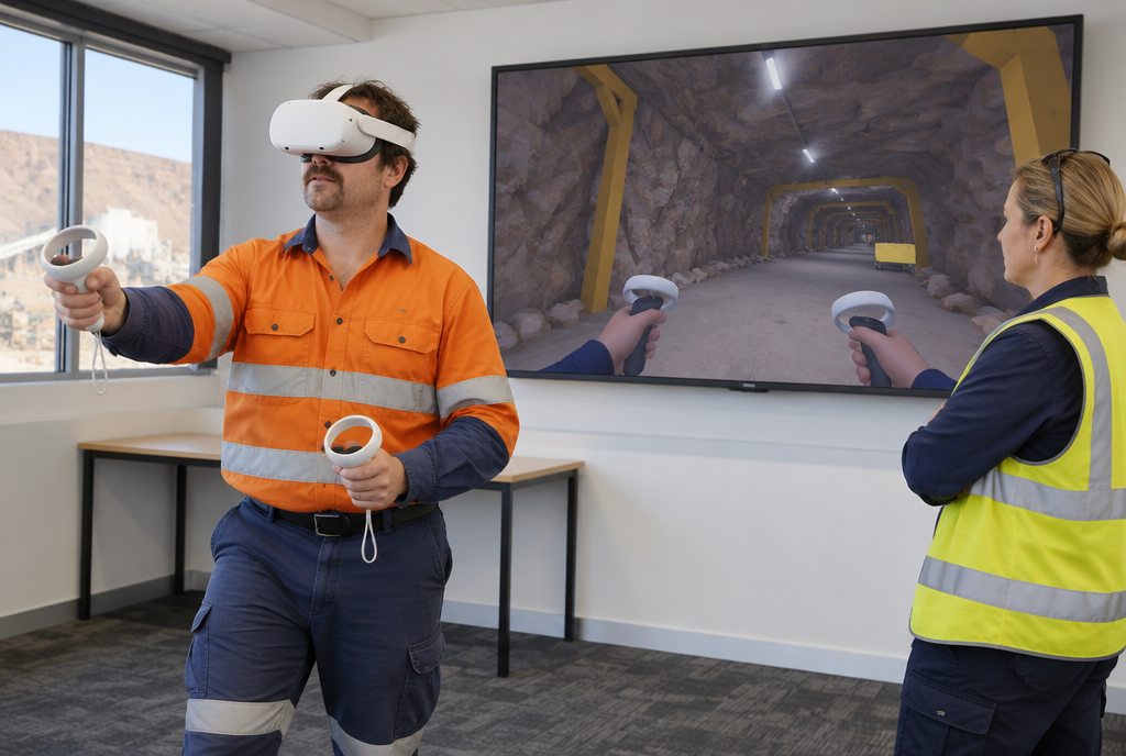
The same 3D model that powers monitoring can be used for inductions and emergency drills in VR, so crews rehearse on the site they actually work on.
What data does a digital twin need?
Less than most people think, at first. A useful twin needs:
- Geometry accurate enough for the decisions you'll make with it. Survey-grade for measuring movement; recognisable for training and orientation.
- A few live signals that answer a real question: is it running, is it safe, has it changed?
- History, so you can see trends rather than just the current reading.
- Ownership: someone whose job it is to look at the twin and act on it.
Cameras are often the most underrated input. A single well-placed camera, shown in context on the model, answers dozens of "can someone go and check" questions.
How much detail do you really need?
Fidelity should follow purpose. A twin used to measure ground movement needs millimetre-level survey data in the right places. A twin used to check whether a gate is shut needs a camera and a recognisable model. Over-modelling is one of the fastest ways to blow a budget without adding value.
Common mistakes
- Starting with a platform instead of a question. Decide what you want to know and how often, then choose the tools.
- Trying to twin everything at once. One site or one asset class, done well, builds the case for the rest.
- Collecting data nobody acts on. Every sensor should map to a decision or an alert.
- Forgetting the people. If the twin isn't part of someone's daily routine, it decays.
How to start a digital twin project
- List the trips your people make to site and why. The "just checking" trips are your first targets.
- Pick one asset or site where those trips are long, frequent or risky.
- Capture it with the least effort that gives usable geometry: often a drone survey or existing drawings.
- Add the cameras and sensors that answer the questions behind those trips.
- Run it for a few months, count the visits avoided and the faults caught early, then decide what to expand.
That's how we approach digital twin projects at Voxelane: small, measurable and tied to a real cost.